Israel Trail Day 19
Day 19: August 27, 2013
Wikiloc Maps:
Petach Tikvah to the Junction of 5/40
5/40 to El’ad
Day 19
There are some days I’ve had on the trail when everything has seemed fascinating — something new to see with every ten steps, tremendous variety, a great exploration. Then there have been some days where it’s been more a slog from point A to point B because if you’re going to hike the entire distance, there are going to be some places where it’s ground you have to cover. Today’s hike was more in the latter category, although there were at least a couple of interesting discoveries that made the day more than just a physical challenge and another segment on the map.
I had decided to try and get an early start so I could finish earlier in the day, get home in the afternoon, take a nap, and still manage to get some work done. The alarm went off at 5am, but instead of being out the door by 530 so I could be on the trail at Petah Tikvah at 630 I was out the door at 7. And then I had to stop for gas, needed some supplies, and when I got to the train station at Petah Tikvah, where I left off last time, I decided to fortify myself with a cafe hafuch before heading out on the trail, so instead of 630 it was 730 before actually started putting one foot in front of the other in the direction of the trail, but it was still the earliest start I’d gotten.
The trail doesn’t actually go right to the train station, so my first challenge was to get back to the trail. I did the embankment-climbing thing I’d finished my last segment with as the starter. Somehow not an auspicious sign to start a day of hiking on the Israel Trail with concrete and a busy road. With the help of the GPS on the iPhone and the satellite view navigation in Wikiloc I reconnected with the trail in the space of about a mile. I do feel kind of like a sissy relying on satellite navigation and technology to go for a hike — and I did actually learn how to read a map and use a compass as a Boy Scout, skills that were reinforced in basic training in the US Army — but man, it makes it so much easier. Of course if my battery died or I dropped my phone in the wrong place I’d be like Charlie on the MTA wandering forever, the man who never returned. I solved that problem by buying an external battery that lets me double the life of the battery.
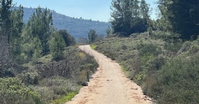
Once I rejoined the trail I stopped looking at the GPS every five minutes and settled into a steady jogging pace, the backpack bouncing up and down. Not fast, probably 13 minute miles, but it was going to be a long day, and five liters of water does add some weight. The first few miles were pretty boring, a dirt road meandering next to the Yarkon River (stream), not much to see except tall reeds and an occasional glimpse of the water. No other hikers or runners, just an occasional bicyclist sharing the trail.
Israelis love commemorating things out in the woods. I’ll be jogging along and come across signs marking all sorts of things, some significant, some where you really think they were digging to come up with something to talk about. Today there was a marker commemorating the former site of a large citrus grove as well as the first building in Israel to be constructed of reinforced concrete. OK…and we care because?
After crossing highway 5 for the first time I jogged past an unpleasantly fragrant waste treatment plant….ahh nature… another XX and I came to a surprise, not mentioned in the guidebook: the trail went straight across the river. I wasn’t really expecting to have to do any fording today. And mindful of the pollution being dumped into the stream not that far away, and not knowing what was upstream, I wasn’t really so keen about getting my feet wet, but there was any choice, so I took off my shoes and socks and waded across. The first crossing was pretty easy — there was a paved road that went across, and the water didn’t really get much above my ankles.
The trail continued as it had, dirt roads, now on the edge of agricultural fields, still flat, still boring. After crossing highway 40 I came to my second crossing of the “mighty Yarkon,” at Kanaf Levana where there was another sign describing in great detail the bridge that used to be here. I would rather have had the bridge than the sign talking about it. Off with the shoes, across the stream, back on with the shoes. More sameness on the trail…and another one of the commerorative markers for something that seems to be commemorated for the sake of commemorating, “Beit Pardes,” which the sign informs me is also known as Beit Leah — helpfully offering that no one knows why it’s called Beit Leah.
At Beit Leah the trail once again crosses the Yarkon. This crossing was somewhat trickier. Very uneven, rocky, bumpy, and the rocks were slippery. Just as I was about to start across a bike rider appeared and asked if there was a way to cross the river further down, he was riding his bike to work. I assured him there was, and he watched with amusement as I worked my way across the stream, stepping gingerly, one hand holding my shoes up, the other hand helping steady myself as I worked my way across the stream, rocks painfully poking into my feet as I tried not to fall on my ass. Once I made it across the biker yelled out a cheerful “kol hakavod!” and pedaled off on his merry way. And once again it was “on with the shoes” and back on the trail.
From here the trail got even more boring — and more exposed, with fields on one side and the stream on the other. I crossed under highway 5 again, and was headed south. The monotony was broken up by the exciting sight of the 100 year old first building in Israel built out of reinforced concrete. I should put together a treasure hunt or a trivia contest built on obscure sights you can see along the Israel Trail. After the concrete house the trail at least was back in the shade. I saw a guy fishing who had gotten there on a motorscooter, and was wondering how the hell he managed to transport his fishing pole on a scooter. After another couple miles I came to the Baptist Village.
The Baptist Village was founded in the 1950s by, you guessed, a group of Baptists. I suppose it’s sort of the headquarters for visiting Baptists from America. Rather unassuming place though — everyone else, from Catholics to Mormons have more impressive edifices to welcome pilgrims to the holy land.
The Baptists thoughtfully provide a watering spot for people hiking the Israel Trail. Naturally Baptists would provide water, right? It was a comfortable spot too — there was a covering that provided shade, a bench and table to sit at, as well as the water fountain. The water is served with a mild bit of proselytizing: A sign that brings a quote form the New Testament “Those who drink this water will return and be thirsty, but those that drink the water I [Jesus] provide will never thirst.” I took the “non-Jesus” water, and re-filled my water bag, since I knew I would in fact get thirsty, especially since the temperature was in the 90s and I still had 8 or 9 miles to go.
Leaving the Baptist Village, the trail goes across some more fields and comes to the “water lily pond” at the source of the Yarkon, where the Israeli Water Authority has a big plant. The water up here at the source looked rather more inviting than further down. Clear enough to see fish swimming around in the water. I saw a few people walking around with towels draped over their shoulders, but it wasn’t clear where they were going. I presume there must have been some place suitable for taking a dip nearby.
After another relatively boring stretch, the trail brought me to the most interesting discovery of the day: Tel Afek / Antipatris. Afek is ancient, pre-Hellenistic, which is to say more than 2,400 years old. It was at a pass (VERY modest pass, not much of a hill, but it doesn’t take much of a hill in an area that’s completely flat to give a little bit of a view) on the Via Maris that linked Syria and Egypt. Herod rebuilt it in a grand manner and named it in honor of his father, Antipater. The city was destroyed by an earthquake in 363. The fortress that still dominates the site was built by the Ottomans in 1573.
After Antipatris the trail was on one of those boring stretches — going through agricultural land parallel to highway 6 for about five miles until arriving at El’ad. El’ad is a modern community, built in the 1990s. It’s the only officially designated “religious municipality” in Israel.
I took a taxi back from El’ad to the train station at Rosh Ha’ayin, and then took the train two stops back to the car at the Petah Tikvah station.
“Petah Tikvah to Neve Ne’eman: http://www.wikiloc.com/wikiloc/view.do?id=5122424
Neve Ne’eman to El’Ad: http://www.wikiloc.com/wikiloc/view.do?id=5124300”
From Israel Trail Day 19 Petah Tikvah to El’Ad. Posted by Barry Leff on 8/30/2013 (93 items)
- 730am. Start of Day 19 on the Israel Trail.
- First step was to get back on to the actual trail.
- After about a mile I made it to river and was back on the trail.
- The trail's first of many highway crossings today — under highway 5.
- I had to take my shoes off a couple of times and wade across the Yarkon.
- Workers, I think from the nearby sewage treatment plant, trimming trees.
- Crossing highway 40.
- One benefit of the highway crossings — shade!
- The 2nd time I had to take my shoes off and wade across the Yarkon
- 2nd time crossing highway 5
- The first house in Israel to be built with reinforced concrete, about 100 years ago. …
- Wonder how he carries the fishing poles on the motorcycle?
- This is cool — the Baptist Village, founded as the center for Baptists in Israel in …
- Pillbox setup to protect the rail line between Rosh Ha'Ayin and Petah Tikvah in …
- The water lily pond at the source of the Yarkon
- There are actual fish in the Yarkon River…
- Tel Afek – Antipatris. An interesting archaeological discovery on today's hike.
- The fortress is relatively recent, Ottoman period, but the remains of the Roman Cardo…
- I heard gunfire from inside the park, and thought there must be a shooting range next…
- Trail makers are sometimes tucked into unlikely places.
- This was a long boring stretch from Antipatris to El'Ad…flat, exposed, not muc…
- A nice little wotering spot for hikers, courtesy of the Israeli Water Authority.
- Crossing over highway 6
- Today's destination : El'Ad.
- 17 miles today…welcome to El'Ad…
Generated by Facebook Photo Fetcher 2
(Israel Trail Day 19 Petah Tikvah to El’Ad)


