
Hiking the Taal Volcano
I wrote this as something to go on my company’s “travel wiki” that we have for employees who travel to our facilities in India and the Philippines. I decided to also post it here to make it available on the internet for others who might be interested.
Reb Barry
Manila Day Trip
Hiking the Taal Volcano
 By Barry Leff
The Taal Volcano makes an ideal day trip from Manila. The full day – including picking up a rental car, driving down there, taking a boat to the volcano, hiking down to the lake and back, boating back, stopping for lunch, driving back – at a reasonably leisurely pace – will take about ten hours. You go through some gorgeous countryside, and your visit to the volcano can be as energetic or as relaxed as you prefer.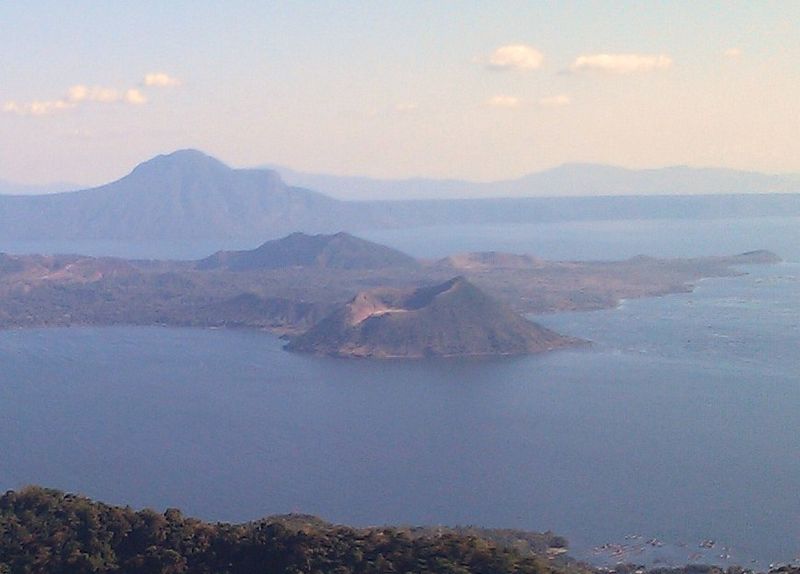
General Information: Vulcano Island (not the most creative name) is an island in Taal Lake, which is itself on an island (Luzon Island, the same island as Manila). Vulcano Island also has a lake you can hike to, known as crater lake, which in turn has a small island. So there is an island in a lake on an island on a lake on an island. It sounds like an infinite regression!
Taal is an active volcano. The Wikipedia entry on Taal Volcano contains a lot interesting information, including a very exciting first hand report of a major volcanic eruption in 1754. The volcano does periodically wake up—there have been 33 eruptions since 1572, including one in 1911 which killed 1,000 people. It would be a good idea to check online before going to make sure the volcano has not entered an active phase.
The wiki entry on Taal Lake is also worthwhile background reading. It contains interesting tidbits like Taal Lake is the only place in the world to host a freshwater sardine.
Hiking / Riding options. You need to choose which trail you want to use before the boat leaves, since the trails start from different prices, and prices vary accordingly. There are three options, the “standard” trail, which just takes you to the rim, the McKinney Trail, which also takes you to the rim but via a different route that has more shade and fewer horses, and the “secret” trail, which I took, which actually allows you to hike down to the lake on the island and go for a swim in the slightly sulphuric water. You can rent a horse, but be forewarned, the horses are more like donkeys than horses, and they aren’t any faster than walking if you are in good shape.
The Taal Lake Yacht Club – more on them later – has a web page that describes the various options here.
 I will describe the Secret Trail, since that’s the one I hiked.
The trail starts at the end of the island NOT visible in the picture above, off to the left. It’s about a 20-30 minute boat ride from the town of Talisay to starting point for the trail. It’s about 45 minutes of hiking each way, fairly steep in places, and with deep, loose dirt in places. I would rate the hike “moderate-difficult.” If you are not in good shape, or if you are not comfortable with shifty, uneven terrain, you might consider riding one of the donkeys.
I was by myself, and just wanted to hike; the locals kept trying to sell me a “horse” or at least a 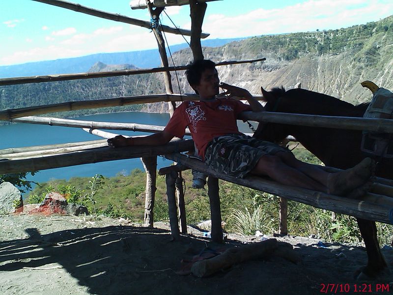 guide. I opted for neither, and for me anyway that was the right choice. The kid peddling the “horse” tried saying it’s far, it’s a big climb, etc. He followed me half way up the hill, no doubt hoping I would decide it was too much effort. Having hiked Mt. Whitney in one da
y – 22 miles with 6500 feet of elevation gain (and 6500 feet descent), I did not find the 45 minute walk overly strenuous. It was quite hot, however, and there was not a lot of shade, only in a few spots. If you walk you really don’t need a guide – calling the trail the “secret” trail is a bit of a misnomer. It’s a relative freeway of trails, you would have to make some exceptional effort to get lost. After about 25 minutes of steady walking uphill I arrived at the ridge and was rewarded with a nice view of the lake (on the island on the lake).
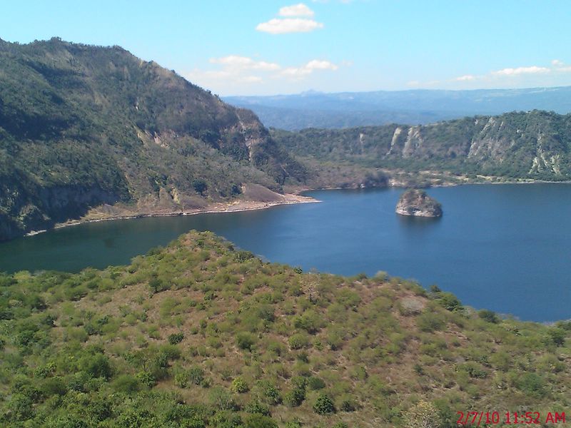 Another 20 minutes or so walking down – with some tricky spots that had deep “dust” on steep downhills – and I was at the lake. Needless to say, by that time I was definitely ready for a swim. When I first put my feet in the water, I was disappointed, because it felt as warm as a hot tub. Fortunately, as I waded a little further out I found a thermocline, and the water temperature dropped enough that it made a welcome contrast to the hot relatively shadeless day.
There is not much in the way of shade right at the lakeshore. It’s a little hard to make out in the picture at the right, but there is dried out old bush that barely casts a little shade. When I saw it, I was reminded of the prophet Jonah, and the shriveled bush he sits under at the end of his big “fish story.” “But when dawn came up the next day, God appointed a worm that attacked the bush, so that it withered. When the sun rose, God prepared a sultry east wind, and the sun beat down on the head of Jonah so that he was faint and asked that he might die.” (Jonah 4:7-8).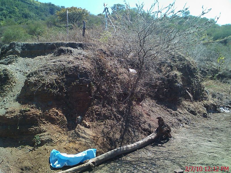
I read that the water in the lake has a high sulphur content, but it wasn’t really noticeable to me. But then again, I live in Israel, and go to the Dead Sea a couple of times a year, so any other water with sulphur or minerals seems tame by comparison.
Getting there: As the crow flies, Taal is remarkably close to Manila – probably no more than 40 miles. It will, however, take you two hours to get there, since you’re not a crow, and there is a lot of traffic.
I rented a car from Europcar at the Intercontinental Hotel in Ayala Center. Cost was 3300 pesos for a day – about $70, which might sound expensive for a small, manual transmission car, but it includes insurance, which I presume must be expensive in the Philippines, because driving there can be a bit adventurous. I understand a car and driver for the day if you are not inclined to drive yourself would cost about 6,000 pesos.
If you drive yourself, ask for directions for how to get on the South Expressway. Signs will say S LEX which stands for “South Luzon Expressway.” But often signs give the names of towns in different directions, without specifying the road, which is not so useful if you are not familiar with the names of the towns. Driving directions can be found on the TLYC web site here, and they worked just fine. It is, however, a lot more than 20 minutes from the expressway to Tagaytay ridge. At least it was for me. Maybe if you drove fast at 2am you could make it in 20 minutes. I would count on more like double that.
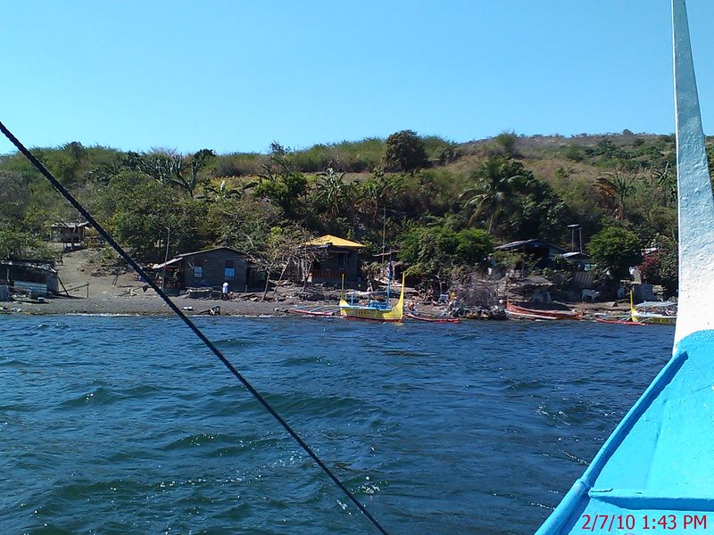
You will need to take a “banca boat” from the town of Talisay on the shores of Lake Taal out to the island. The standard charge from TLYC is 1800 pesos, 2200 pesos if you want to go to the “secret trail.” The boat can carry five people, so if you have a group of five, it’s a bargain; if you’re by yourself, it’s pretty steep. If you’re by yourself, you can hang out and try to join a group of 2 or 3. While I was there the only group filled two boats, so I had to go by myself. But the staff at TLYC organized a boat for me, not officially affiliated with them, for 1400 pesos to secret trail. I definitely recommend going with TLYC, they were nice, organized, answer emails, easy to find, etc. There are hawkers on the road who will try and sell you a boat ride, but I felt more comfortable going somewhere that I had made contact before, who have a web site, they give life vests, etc.
Another benefit of TLYC is they have showers you can use afterwards – and believe me, after an hour and a half of hiking in the heat, and a dip in a sulphury lake, you’ll need a shower!
 After the shower, I did some exploring in the car. Instead of going back the way I came, I continued along the lake shore in the direction I had been going to get to TLYC; eventually I found a different road that headed up the hill to Tagaytay, and took that. Watch carefully for it, there is only a small easy to miss sign, and it’s not a big road. But it was a good choice. Narrow (one lane in places, narrower than a typical driveway!), windy, but some very nice views.
Once you are back up to Tagaytay, there are many bars, restaurants, and coffeeshops along the road that runs along the ridge. I found a place to sit and have a bite to eat, and drink a beer admiring the great view – many of the restaurants along the ridge have awesome views of the volcano.
Words of wisdom:
· It’s a good idea to bring a backpack to carry your supplies.
· Bring sunscreen, sunglasses, and a hat, there is not much shade on the trail.
· Getting a very early start would be an excellent idea as it will not be as hot. There are plenty of places in the area you could stay overnight the night before if you were so inclined.
· Bring at least two liters of water per person.
· When driving on the S LEX, there are a few rest stops with gas stations, Starbucks, etc. But be warned they are not marked well and come up quickly. When you see the tall gas station signs coming up, pull over…they don’t have nearly as good signage and indications of where to turn off as in the US or Israel.
Costs:
· Rental car: 3300 pesos
· Gas: 300 pesos
· Tolls: 70 pesos each way
· Boat Rental: 1400-2200 pesos per boat load
· Entry and boat landing fee (paid on Vulcano Island): 100 pesos
Make sure you have cash for the boat rental, tolls, and entry/landing fees.
nice read about the secret trail in Taal. I live in the philippines , but then it’s my first time to take the secret trail this weekend. thanks